Geospatial Market Size, Share, Trends, Growth, and Industry Analysis, By End-user (Defense & Internal Security, Government, Banking, Financial Services, Healthcare & Life Sciences & Others), By Enterprise Type (Large, Small and Medium Enterprises), By Solution (Data Integration and ETL, Geocoding and Reverse Geocoding, Thematic Mapping & Spatial Analysis, Reporting & Visualization, and Others), By Application (Disaster Management & Risk Reduction, Public Safety & Others), By Deployment (On-Premises and Cloud)) Regional Analysis and Forecast 2032.
Global Geospatial market is predicted to reach approximately USD 189.25 billion by 2032, at a CAGR of 12.54% from 2024 to 2032.
Geospatial solutions encompass various technologies like satellite imagery, GPS, GIS, and mapping software. These tools allow users to access and analyse location-related data. They have transformed industries like agriculture, urban design, transportation, and environmental protection. Artificial intelligence and machine learning advancements are boosting the geospatial market, leading to advancements and increased efficiency in multiple sectors. As businesses and governments increasingly recognize the value of spatial data in decision-making processes, the demand for geospatial products and services continues to soar globally, fostering collaborations and partnerships to harness the full potential of location intelligence.
Global Geospatial report scope and segmentation.
|
Report Attribute |
Details |
|
Estimated Market Value (2023) |
USD 65.35 Billion |
|
Projected Market Value (2032) |
USD 189.25 Billion |
|
Base Year |
2023 |
|
Forecast Years |
2024 – 2032 |
|
Scope of the Report |
Historical and Forecast Trends, Industry Drivers and Constraints, Historical and Forecast Market Analysis by Segment- Based on By Enterprise Type, By End-Use, By Solution, By Deployment, By Application & Region. |
|
Segments Covered |
By Enterprise Type, By End-Use, By Solution, By Deployment, By Application, & By Region. |
|
Forecast Units |
Value (USD million or Billion), and Volume (Units) |
|
Quantitative Units |
Revenue in USD million/billion and CAGR from 2024 to 2032. |
|
Regions Covered |
North America, Europe, Asia Pacific, Latin America, and Middle East & Africa. |
|
Countries Covered |
U.S., Canada, Mexico, U.K., Germany, France, Italy, Spain, China, India, Japan, South Korea, Brazil, Argentina, GCC Countries, and South Africa, among others. |
|
Report Coverage |
Market growth drivers, restraints, opportunities, Porter’s five forces analysis, PEST analysis, value chain analysis, regulatory landscape, market attractiveness analysis by segments and region, company market share analysis. |
|
Delivery Format |
Delivered as an attached PDF and Excel through email, according to the purchase option. |
Global Geospatial dynamics
As satellite technology, GPS systems, and data analysis improve, the demand for geospatial solutions is skyrocketing, mirroring the surge in traffic during the morning rush hour. This demand stems from the increasing need for location-based insights in various industries. Geospatial solutions are driven by our innate desire to comprehend and navigate our surroundings, from enhancing agricultural practices to feed a growing population to designing safer and more efficient transportation networks that connect communities. Moreover, the increasing availability of user-friendly mapping applications and consumer GPS devices makes location-based services more accessible than ever, resembling the convenience of finding your way with a trusted friend guiding you through unfamiliar streets. However, just as cities face challenges like congestion and urban sprawl, the geospatial market encounters hurdles such as data privacy concerns and interoperability issues. Yet, like a community coming together to address common challenges, industry stakeholders collaborate to overcome these obstacles, fostering innovation and ensuring that the benefits of geospatial technology are realized by all. As the geospatial landscape continues to evolve, driven by human curiosity and ingenuity, it remains an exciting journey where every turn offers new opportunities for exploration and growth.
Global Geospatial drivers
Technological advancements, particularly the incorporation of AI and ML into geospatial solutions, are fuelling market growth. AI and ML improve data analysis, leading to more precise predictions and insights from geospatial data. These technologies can, for example, analyse satellite images to detect crop health patterns, aiding farmers in optimizing irrigation and fertilization. Moreover, enhanced satellite imagery resolution and the widespread availability of high-resolution drone cameras are broadening the range of geospatial data applications, driving demand across various industries.
Government support for geospatial technologies is boosting their market growth. Governments understand the value of geospatial data for projects like building infrastructure, handling disasters, and designing cities. For instance, programs like the EU's Copernicus offer free satellite data for environmental monitoring and responding to emergencies. Similarly, government mandates requiring the integration of geospatial information in public projects, such as transportation infrastructure and smart city initiatives, create a steady demand for geospatial solutions. These policies not only stimulate market growth but also foster collaboration between public and private sectors, driving innovation and technological advancements.
Restraints:
Protecting the privacy and security of data is a major concern for the geospatial industry. As location-based services grow and collect more data, keeping this information safe from unauthorized access and misuse is essential. Laws like the European Union's General Data Protection Regulation (GDPR) set strict rules for collecting, storing, and using location data, adding to the challenges faced by businesses in this field. Addressing these concerns requires robust security measures, transparent data policies, and adherence to regulatory frameworks to ensure trust and confidence among users.
Differences between systems and platforms in how they handle geospatial data make it hard for them to work together. Incompatible formats, standards, and protocols create barriers that make geospatial information less accessible and useful. For example, it can be hard to connect GIS data with ERP systems or sensor networks in smart infrastructure projects. To solve these problems, the industry needs to work together to create standard data formats and protocols, as well as software that can work together. Additionally, investments in interoperability infrastructure and tools are needed to facilitate data sharing and integration across diverse applications and stakeholders.
Opportunities:
The rise of autonomous vehicles presents lucrative opportunities for the geospatial market. Geospatial technologies, including high-precision GPS, LiDAR, and HD mapping, play a crucial role in enabling the navigation and decision-making capabilities of autonomous vehicles. These technologies provide real-time location data, environmental mapping, and obstacle detection, enhancing the safety and efficiency of autonomous transportation systems. Moreover, the integration of geospatial analytics enables predictive modelling for route optimization, traffic management, and dynamic re-routing, unlocking new possibilities for intelligent mobility solutions.
Segment Overview
By end-user, the market caters to a wide array of sectors including Defense & Internal Security, Government, Banking, Financial Services, Healthcare & Life Sciences, and Others. Defense & Internal Security relies on geospatial solutions for situational awareness, intelligence gathering, and mission planning. Governments utilize geospatial technology for urban planning, land management, and environmental monitoring. Banking and Financial Services leverage location intelligence for risk assessment, fraud detection, and customer analytics. Healthcare & Life Sciences benefit from geospatial data for disease mapping, epidemiological studies, and patient care optimization. Other industries, such as retail, utilities, and transportation, also utilize geospatial solutions for various applications.
Segmentation by enterprise type distinguishes between Large Enterprises and Small and Medium Enterprises (SMEs). Large enterprises often have complex geospatial requirements and invest in comprehensive solutions for spatial analysis, reporting, and visualization. On the other hand, SMEs may opt for more streamlined geospatial solutions tailored to their specific needs and budget constraints.
The market also categorizes solutions into different categories including Data Integration and ETL (Extract, Transform, Load), Geocoding and Reverse Geocoding, Thematic Mapping & Spatial Analysis, Reporting & Visualization, and Others. Data Integration and ETL tools facilitate the seamless integration of geospatial data from multiple sources, ensuring data consistency and accuracy. Geocoding and Reverse Geocoding solutions convert addresses into geographic coordinates and vice versa, enabling precise location-based queries and analysis. Thematic Mapping & Spatial Analysis tools enable users to visualize and analyse spatial patterns and relationships in geospatial data. Reporting & Visualization solutions offer intuitive interfaces and customizable dashboards for presenting geospatial insights to stakeholders.
Deployment options include On-Premises and Cloud-based solutions, providing flexibility in infrastructure management and scalability. On-Premises deployments offer greater control over data security and customization, while Cloud-based deployments offer scalability, accessibility, and cost-effectiveness.
Applications such as Disaster Management & Risk Reduction and Public Safety utilize geospatial technology for emergency response planning, hazard mapping, and situational awareness. These applications leverage real-time spatial data to mitigate risks, coordinate response efforts, and ensure the safety and well-being of communities.
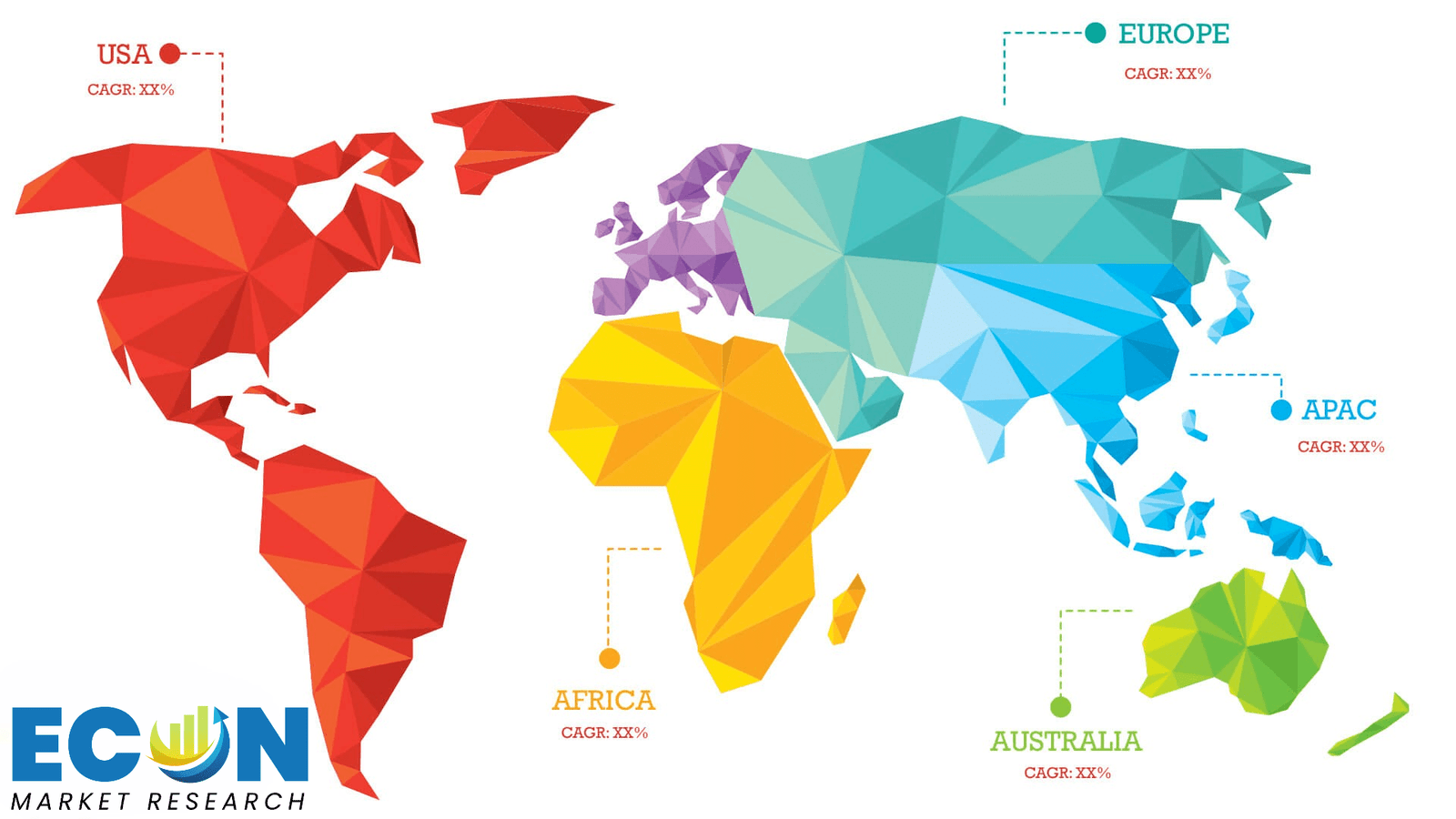
Global Geospatial Overview by Region
North America, with its robust technological infrastructure and early adoption of geospatial solutions, leads the market, driven by demand from sectors like defense, government, and technology. Europe follows closely, leveraging initiatives like the European Union's Copernicus program to promote geospatial innovation and sustainability. In Asia-Pacific, rapid urbanization and infrastructure development fuel the demand for geospatial technologies, particularly in emerging economies like China and India. Moreover, the region's growing awareness of climate change and natural disasters drives investments in geospatial solutions for disaster management and environmental monitoring. In Latin America and the Middle East & Africa, governments are increasingly recognizing the importance of geospatial data in addressing socio-economic challenges and fostering sustainable development. However, factors such as limited infrastructure and regulatory barriers pose challenges to market growth in these regions.
Global Geospatial market competitive landscape
Established players like Esri, Google, and Trimble vie for dominance, leveraging their extensive expertise and robust product portfolios to cater to diverse customer needs. These industry giants continuously invest in research and development to enhance their offerings, staying ahead of the curve in areas such as AI-powered analytics, cloud-based solutions, and mobile applications. Meanwhile, a plethora of nimble startups and niche players inject dynamism into the market, disrupting traditional paradigms with specialized solutions tailored to specific industries or use cases. Innovative companies are using agile techniques to solve problems in the geospatial field by thinking outside the box. Additionally, strategic partnerships between companies create a more competitive environment, which leads to more innovation and a wider market reach. Collaboration between technology and data providers, as well as other stakeholders in the industry, makes it easier to work together and speeds up the process of creating new things. This leads to a wide range of cutting-edge geospatial solutions that are useful for end-users.
Global Geospatial Recent Developments
Scope of global Geospatial report
Global Geospatial report segmentation
|
ATTRIBUTE |
DETAILS |
|
By End-user |
|
|
By Enterprise Type |
|
|
By Solution |
|
|
By Deployment |
|
|
By Application |
|
|
By Geography |
|
|
Customization Scope |
|
|
Pricing |
|
Objectives of the Study
The objectives of the study are summarized in 5 stages. They are as mentioned below:
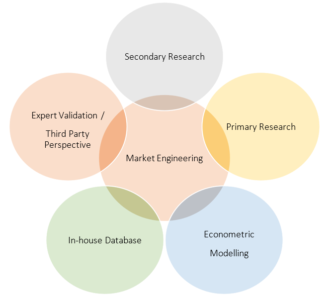
Research Methodology
Our research methodology has always been the key differentiating reason which sets us apart in comparison from the competing organizations in the industry. Our organization believes in consistency along with quality and establishing a new level with every new report we generate; our methods are acclaimed and the data/information inside the report is coveted. Our research methodology involves a combination of primary and secondary research methods. Data procurement is one of the most extensive stages in our research process. Our organization helps in assisting the clients to find the opportunities by examining the market across the globe coupled with providing economic statistics for each and every region. The reports generated and published are based on primary & secondary research. In secondary research, we gather data for global Market through white papers, case studies, blogs, reference customers, news, articles, press releases, white papers, and research studies. We also have our paid data applications which includes hoovers, Bloomberg business week, Avention, and others.
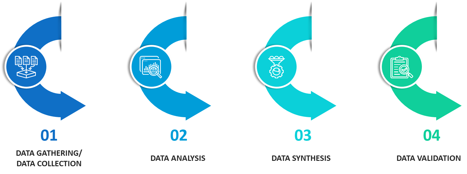
Data Collection
Data collection is the process of gathering, measuring, and analyzing accurate and relevant data from a variety of sources to analyze market and forecast trends. Raw market data is obtained on a broad front. Data is continuously extracted and filtered to ensure only validated and authenticated sources are considered. Data is mined from a varied host of sources including secondary and primary sources.
Primary Research
After the secondary research process, we initiate the primary research phase in which we interact with companies operating within the market space. We interact with related industries to understand the factors that can drive or hamper a market. Exhaustive primary interviews are conducted. Various sources from both the supply and demand sides are interviewed to obtain qualitative and quantitative information for a report which includes suppliers, product providers, domain experts, CEOs, vice presidents, marketing & sales directors, Type & innovation directors, and related key executives from various key companies to ensure a holistic and unbiased picture of the market.
Secondary Research
A secondary research process is conducted to identify and collect information useful for the extensive, technical, market-oriented, and comprehensive study of the market. Secondary sources include published market studies, competitive information, white papers, analyst reports, government agencies, industry and trade associations, media sources, chambers of commerce, newsletters, trade publications, magazines, Bloomberg BusinessWeek, Factiva, D&B, annual reports, company house documents, investor presentations, articles, journals, blogs, and SEC filings of companies, newspapers, and so on. We have assigned weights to these parameters and quantified their market impacts using the weighted average analysis to derive the expected market growth rate.
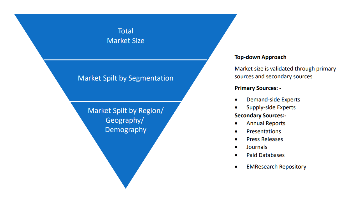
Top-Down Approach & Bottom-Up Approach
In the top – down approach, the Global Batteries for Solar Energy Storage Market was further divided into various segments on the basis of the percentage share of each segment. This approach helped in arriving at the market size of each segment globally. The segments market size was further broken down in the regional market size of each segment and sub-segments. The sub-segments were further broken down to country level market. The market size arrived using this approach was then crosschecked with the market size arrived by using bottom-up approach.
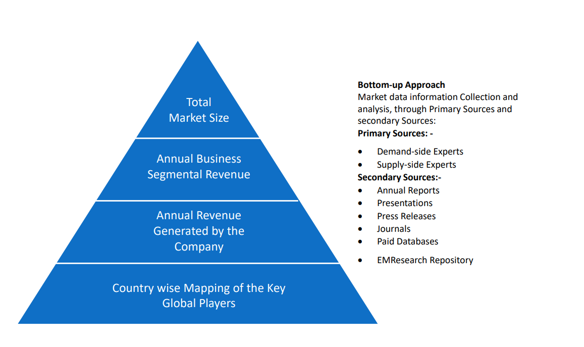
In the bottom-up approach, we arrived at the country market size by identifying the revenues and market shares of the key market players. The country market sizes then were added up to arrive at regional market size of the decorated apparel, which eventually added up to arrive at global market size.
This is one of the most reliable methods as the information is directly obtained from the key players in the market and is based on the primary interviews from the key opinion leaders associated with the firms considered in the research. Furthermore, the data obtained from the company sources and the primary respondents was validated through secondary sources including government publications and Bloomberg.
Market Analysis & size Estimation
Post the data mining stage, we gather our findings and analyze them, filtering out relevant insights. These are evaluated across research teams and industry experts. All this data is collected and evaluated by our analysts. The key players in the industry or markets are identified through extensive primary and secondary research. All percentage share splits, and breakdowns have been determined using secondary sources and verified through primary sources. The market size, in terms of value and volume, is determined through primary and secondary research processes, and forecasting models including the time series model, econometric model, judgmental forecasting model, the Delphi method, among Flywheel Energy Storage. Gathered information for market analysis, competitive landscape, growth trends, product development, and pricing trends is fed into the model and analyzed simultaneously.
Quality Checking & Final Review
The analysis done by the research team is further reviewed to check for the accuracy of the data provided to ensure the clients’ requirements. This approach provides essential checks and balances which facilitate the production of quality data. This Type of revision was done in two phases for the authenticity of the data and negligible errors in the report. After quality checking, the report is reviewed to look after the presentation, Type and to recheck if all the requirements of the clients were addressed.